Walking is the oldest way of travelling, as the stories of pilgrims, saints and merchants testify. Today, retracing the ancient paths and historic roads travelled over the centuries by our ancestors allows us to rediscover the magic of slow travel and the wonders of our country.
Beautiful valleys, historic villages or intricate forests can become even more evocative places if explored on foot.
Here are the most beautiful paths between spirituality, history and nature to explore in spring.
13 paths perfect for spring
Via Francigena
Southern Via Francigena
Mediterranean Path
Blue Trail
Path of the Gods
Ring of Portonovo
Stromboli on foot
Via degli Abati
Way of Francis
Dante's Way
Way of the Brigands
100 Towers Walk
Way of Saint Vili
READ ALSO: MOST BEAUTIFUL BEACHES FOR SPRING WALKS
The most beautiful walks to do in spring in Italy
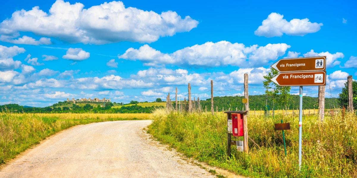
Via Francigena, from Rome to Canterbury
The Via Francigena is an ancient road that pilgrims travelled at the turn of the first millennium from Western Europe, particularly France, either to pray at the tomb of the Apostle Peter in Rome or to continue on to Apulia, where the ports of embarkation for the Holy Land were located. Today, the Via Francigena has become a route for nature lovers, sports enthusiasts and those who want to discover the history, traditions and folklore of the area to be crossed slowly, on foot or by bicycle. The main stages of the ancient road are four just like the four countries it crosses: Great Britain, France, Switzerland and Italy. The Italian section of the Via Francigena begins at the Great St. Bernard Pass, following in the footsteps of Sigeric, the archbishop of Canterbury who in 990 was the first to undertake the journey from Rome to England.
After admiring the beauties of the Val d'Aosta, we continue in Piedmont and lower Lombardy among the countryside and rice cultivations. The boat of the Transitum Padi (ford of the river Po) accompanies the pilgrim to Emilia, then on to the foothills of the Apennines. Reaching the Cisa Pass, one crosses all of beautiful Tuscany from Garfagnana to Chianti to the Crete Senesi, and then enters Lazio through enchanting Tuscia until reaching the outskirts of Rome and then the final destination, St. Peter's Basilica. This is the official Italian route of the Via Francigena, about 1,020 km long, and recognised by the MIBAC (Ministry of Cultural Heritage) and the Council of Europe. There are also officially approved variants as well as alternative routes, generally recommended in the event of bad weather or momentary problems along the route.
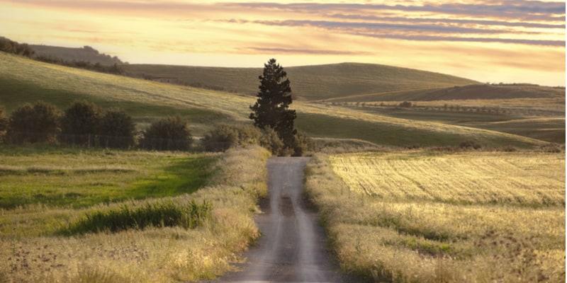
The Southern Via Francigena, from Rome to Santa Maria di Leuca
When speaking of the Via Francigena, one cannot fail to mention its southern part leading from Rome to Santa Maria di Leuca in Apulia. This was in fact the ancient route taken by pilgrims on their way to the Holy Land. The Vie Francigene in the South connect the West to the East, Christianity to paganism, the Ancient Age to the Middle Ages. It is a cross-route between Roman paving stones and ancient sheep-tracks, pagan temples, imposing cathedrals and Christian sanctuaries, gentle hilly landscapes and rugged mountain passages. Along the way from Rome to Santa Maria di Leuca, moreover, you could take several detours to discover less explored territories. For example, once you arrive in Apulia, the approximately 110 km-long route starts from Troia, passing through the towns of Lucera, San Severo, San Marco in Lamis and San Giovanni Rotondo, to reach Monte Sant'Angelo, a Unesco World Heritage site and an important pilgrimage destination for the cult of the Archangel Michael.
From Monte Sant'Angelo we then set off along the coastal road towards Bari. Again from Apulia, then, precisely in Ordona, another path leads to Matera, the city of the Sassi in Basilicata. On the official website of the Vie Francigene del Sud you will find all the itineraries.
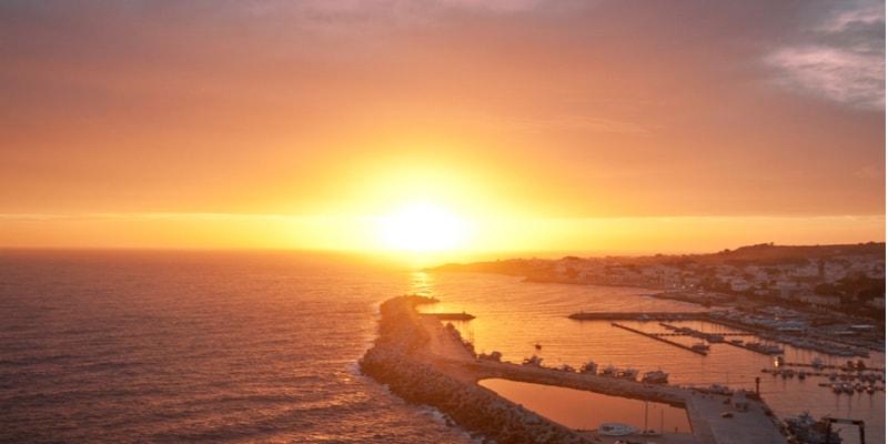
Mediterranean Path, from Basilicata to Spain
The Mediterranean Path is an ancient route traversed over time by pilgrims and merchants that traces medieval communication routes. It is an incredible trail that starts in Italy, precisely in Basilicata, in Maratea, then crosses France and ends in Spain, thus connecting three different European countries along the northern coast of the Mediterranean. Developed by the European Rumblers Association and the Italian Hiking Federation, the Mediterranean Trail, identified as E12, is a 1460.32 km long route that almost draws a ring around the Mediterranean Sea. The starting point is on the Lucania side of the Castrocucco beach, on the border between Basilicata and Calabria. The path then crosses the entire Tyrrhenian coast of Basilicata, about 32 km long. It follows the dolomite ridge leading to the inlet of Capo La Secca, where fish farming was practised in Roman times. Continuing along the path overlooked by the castle of Castrocucco, we pass the Orto beach, the scenic Punta Caina, dominated by a medieval tower, and finally reach Marina di Maratea. After passing Basilicata, the Mediterranean Path continues through Campania, Lazio, Tuscany and finally Liguria, ending in Ventimiglia, where the last section of the Italian part of the route joins the French part and then reaches the Spanish part. From the most barren lands to the most luxuriant, the route amazes with the great variety of landscapes and the biodiversity of the environments crossed.
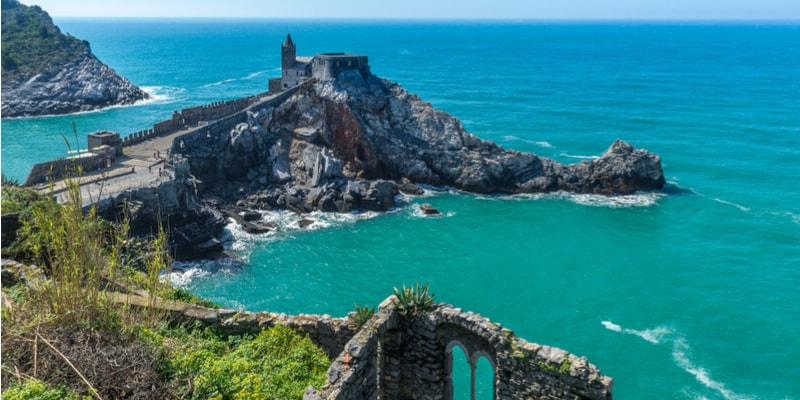
Sentiero L'Infinito and Sentiero Azzurro, Liguria, Cinque Terre
What better way to explore the Cinque Terre than on foot? Among the many paths crossing Liguria, we recommend two with a sea view, ideal for spring.
The L'Infinito path is a scenic route connecting Portovenere with Riomaggiore. It is an ancient 14 km long path that takes 3 to 4 hours depending on one's pace. The start is in Portovenere, in Piazza Bastreri, and then you begin the first section of the trail, which, via a flight of stone steps, runs alongside the Doria castle, offering spectacular views of the three islands of Palmaria, Tino and Tinetto. We then take the path marked in white and red by the Cai to reach the first stage, Campiglia. From Campiglia, one continues on to Riomaggiore, but first climbs to Colle Telegrafo from which to admire the panorama. Amidst cultivated terraces, scents and roads marked by the typical dry stone walls, the ciàn, we arrive at the Sanctuary of Nostra Madonna di Montenero, at an altitude of just over 300 metres, and finally at the colourful village of Riomaggiore. The Sentiero Azzurro, on the other hand, is an easier route and one of the most spectacular in the Cinque Terre. It is path No. 2, marked by a white and a blue stripe, which winds along the sea connecting the five villages. The itinerary from Riomaggiore to Monterosso is about 12 km long and the highest altitude (200 m) is reached at Prevo, a small hamlet of Vernazza. The route consists mostly of paths, cobbled mule tracks and steps, the Via dell'Amore promenade and internal village roads. Together with the Via dell'Amore, which dates back to the 1930s, the Sentiero Azzurro is an ancient route, well known at the time of the Republic of Genoa, when Vernazza was the main port of call and trading point in the area.
Path of the Gods, Campania
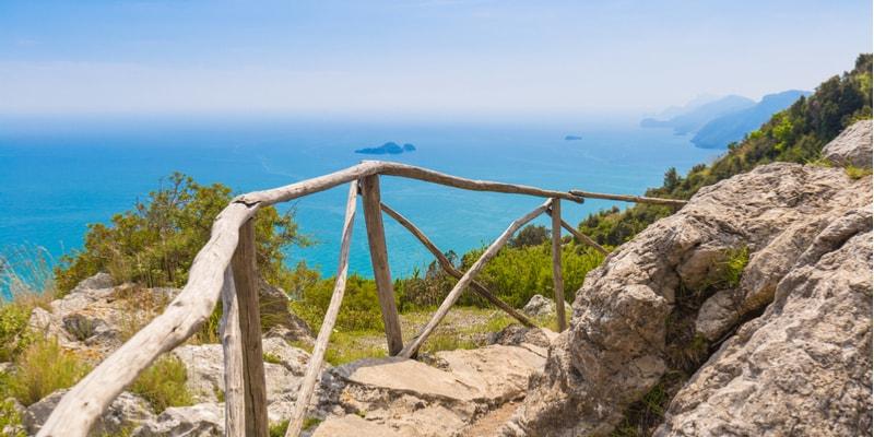
It is the path of paths. The Sentiero degli Dei (Path of the Gods) is the most beautiful panoramic path with a sea view on the Amalfi Coast and one of the most beautiful in Italy, ideal for spring.
The Sentiero degli Dei (Path of the Gods) starts from the church of San Matteo in Bomerano, a hamlet of Agerola 650 metres above sea level, then crosses Nocelle and continues along the ancient route of Hellenic settlers once dominated by temples. Finally, it descends to Positano via 1500 steps. The path, which we recommend tackling from top to bottom, is marked with white and red signs numbered 02. It is an 8 km tourist trail and of slight difficulty, but is not recommended for those suffering from vertigo. The walking time is about four and a half hours. During the walk through the Mediterranean maquis, you will be able to enjoy the splendid views of the coastline and the sea as far as the eye can see. The path still retains all its charm, which has inspired numerous writers and poets over time. Among them, Italo Calvino described the Sentiero degli Dei (Gods' Path) as 'that road suspended over the magical gulf of the Sirens still ploughed by memory and myth'.
The Ring of Portonovo, Marche
Path 309 in the Conero Park, called the Anello di Portonovo, explores the best of the Marche region's bay famous for its blue flag beaches but also for its nature trails just a few kilometres from Ancona. It is an easy route lasting 1 hour and 30 minutes, to be tackled on foot or by mountain bike. It starts from the square in Portonovo and continues to Lago Grande, ideal for birdwatchers. You reach the Fortino Napoleonico, a building dating back to the early 19th century that now houses a hotel, and then the imposing watchtower, also known as Torre Clementina or Torre De Bosis, dating back to the 18th century, which in the following centuries hosted great men of letters such as Gabriele D'Annunzio. This leads to the church of Santa Maria di Portonovo, a jewel of Romanesque art just a few steps from the sea, in front of the beautiful Vela beach.
The church, even mentioned by Dante in the Divine Comedy, can be visited today but is not always open. Not far from the church is another brackish lake, Lago Profondo, located right on the slopes of Monte Conero. Finally, you will return to the starting point on path 309.
Stromboli, Aeolian Islands, Sicily
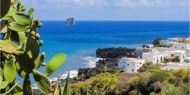
Hiking to the top of Stromboli is one of those experiences you have to have at least once in your life. The volcano of Stromboli has been one of the most active in the world for more than 2500 years and the constant eruptions create a magical spectacle at night. Several associations in San Vincenzo organise day or night excursions to the volcano and provide everything necessary to experience it safely. Two different trails start from San Vincenzo and one from Ginostra to reach the summit of the volcano at 926 metres above sea level. The path leading from San Vincenzo to Pizzo sopra la Fossa is recognised as the safest way to reach the summit of the volcano. The path leading to the craters has an average width of one metre, is well signposted and easy to walk, alternating between sandy and rocky terrain. Once you reach Pizzo sopra la Fossa, you will find yourself in a lunar landscape among smoking craters. The path leading from Piazza San Vincenzo to the Sciara del Fuoco is an easier alternative. It starts at the church of San Vincenzo and continues to the old cemetery where Strombolicchio, an islet to the north-east of Stromboli, is clearly visible. Thus one arrives at the rocky ridge of Cannestrà, overhanging to the west and then continuing westwards towards Vallonazzo, a place where one can appreciate the majesty of the ravine. Lastly, the path from Ginostra to Portella Ginostra allows you to reach an altitude of 800 metres by walking along the western edge of the Sciara del Fuoco to Pizzo.
You will be struck by the unusual rolling of boulders that run along the entire Sciara until they crash into the waves. However, the view from the top of the volcano is breathtaking and on a clear day you can even make out Mount Etna. Of course, the intensity of the eruptions and their frequency cannot be predicted, as they pace the ascent up to Pizzo, a unique amphitheatre from which to admire Stromboli in all its majesty. Spring is the ideal season to make these excursions when the temperature is not yet too high; sunset is clearly the most suggestive moment.
Via degli Abati, from Emilia-Romagna to Tuscany
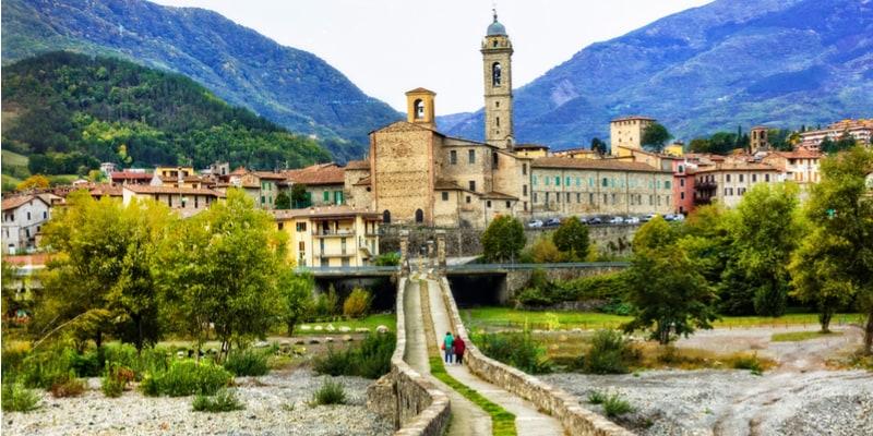
The Via degli Abati is a 120-km-long route that connects the town of Bobbio in the Apennines of Piacenza to Pontremoli on the border between Liguria, Tuscany and Emilia-Romagna, where it connects to the Via Francigena. The Via degli Abati, about 190 km and a maximum altitude difference of 4000 metres, is older than the Via Francigena. There is evidence, in fact, that the paths of the Via degli Abati were already in use three centuries before 990 AD, when Sigeric travelled the historic route from Rome to Canterbury. The Via degli Abati is linked to the history of Bobbio and its abbey, founded in the 7th century AD by St Columba, an Irish monk. The abbey soon became a place of study and prayer, and after Columbanus's death and subsequent canonisation, his devotees began to visit Bobbio and the surrounding area, and then on to Rome. Also known as the 'Francigena di Montagna', the Via degli Abati therefore connects Bobbio to Pontremoli, passing through Pavia, along the Trebbia Valley and the Tuscan-Emilian Apennines, through extraordinarily evocative places of faith such as the Abbey of San Colombano, characteristic villages such as Bobbio or Pontremoli, splendid castles such as that of Bardi and uncontaminated landscapes of rare beauty in the Parma Apennines.
The Via di Francesco, Umbria
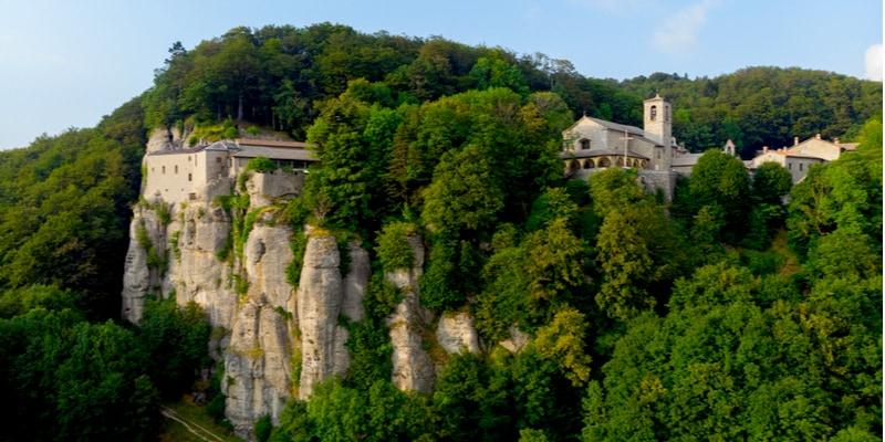
This is a unique walk in the footsteps of Saint Francis to reach Assisi starting from the north (La Verna) or the south (Rome). A pilgrimage to retrace on foot, by bicycle or on horseback some of the places that bear witness to the life and preaching of the Saint of Assisi.
The route consists of eight stages if one starts from La Verna and arrives in Assisi, ten stages from Greccio to Assisi (with variants for Perugia and Terni). Crossing the heart of Italy, between Umbria, Tuscany and Lazio, admiring the same landscapes admired by Francis, returning to the same places that still echo his words and deeds, meeting people related to him, is a true spiritual experience for believers of all times.
Dante's Way, between Romagna and Tuscany
The Cammino di Dante (Dante's Path) is the first itinerary along the medieval paths and roads that joined Romagna and Tuscany, travelled by the Supreme Poet at the time of his exile, the period in which he wrote the Divine Comedy. The route rediscovers the ancient roads that connected Florence and Ravenna, the city of his birth and the city where the Poet died. The itineraries therefore wind through those places in the Tuscan-Romagna territory mentioned in the Divine Comedy, or directly experienced by the Poet during his years of exile. The paths that make up the itineraries, in most cases, are 'ridge paths' used from the late Middle Ages until the development of the current road network dating back to the late 19th century. In places, these medieval paths coincide with ancient Etruscan-Roman roads, easily recognisable by their typical cobblestones. The route develops through a ring of about 400 km linking Romagna and Casentino, for a total of 20 fixed stages, to be travelled anti-clockwise. The starting point is Dante's Tomb in Ravenna, and the finishing point, the Museo Casa di Dante in Florence. The Cammino di Dante is therefore not only a trekking route, but also a cultural, artistic, philosophical and spiritual journey.
The itinerary will make you rediscover the marvellous landscapes of Romagna and Casentino, relive the splendour of the Counts Guidi and their castles rich in history and mysteries, immerse yourself in the limpid Acquacheta stream, admire the majestic beauty of the Casentino Forests and regenerate yourself in its hermitages.
The Way of the Brigantes, between Lazio and Abruzzo
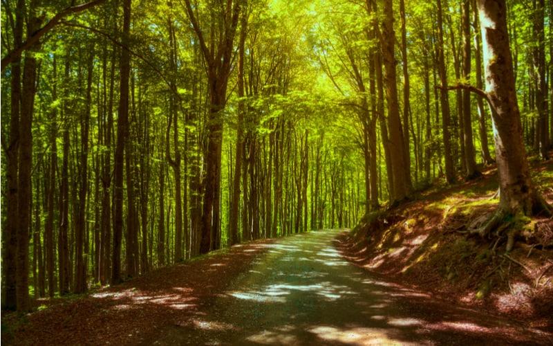
The Cammino dei Briganti is a 100-kilometre loop trail on the border between Lazio and Abruzzo which, in the mid-19th century, formed the boundary between the Papal State and the Kingdom of the Two Sicilies. It is a path that runs at medium altitudes (between 800 and 1,300 metres above sea level) in the footsteps of the brigands of the Banda di Cartore between the Val de Varri, the Valle del Salto and the slopes of Monte Velino. It usually takes seven days to complete the walk, which starts and returns to the village of Sante Marie, in the province of L'Aquila. The route is divided into seven stages and crosses Marsica in Abruzzo and Cicolano in Lazio, those mountains in the Apennines where brigands took refuge a century and a half ago. Returning to the places where the brigands fought against the invasion of the House of Savoy means reliving an important page of Italian history. Among woods, mountains and villages, the Cammino dei Briganti is also the ideal route for those who want to discover the wilder face of the Apennines.
The Cammino 100 Torri, Sardinia
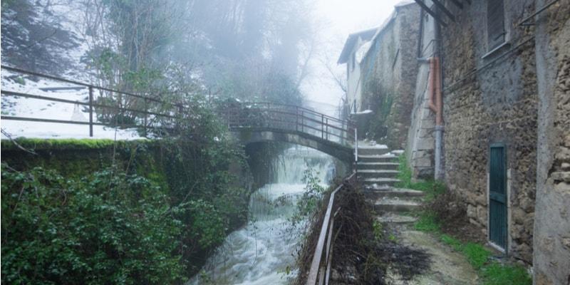
The Cammino 100 Torri is a scenic route that winds along the coast of Sardinia for 1284 km. It takes its name from the 105 coastal towers that punctuate the path, which never strays more than two kilometres from the sea and runs counterclockwise around the island. Starting from Cagliari, it explores beaches, dunes, churches, lighthouses, villages and inaccessible places.
The route is divided into two paths, the Eastern Path and the Western Path, which you can also walk separately. The Eastern Path, 597 km long, crosses beaches and dirt roads from Cagliari to Gallura, losing itself in the Mediterranean maquis. The Western Path, 634 km long, runs along dirt roads and freshwater ponds, lagoons and coastal dunes from Castelsardo to Cagliari. Along ancient paths and mule tracks you will discover the most authentic soul of Sardinia.
The Cammino di San Vili, Trentino
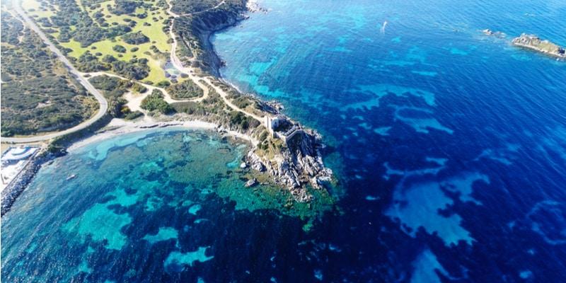
The Cammino di San Vili takes its name from Saint Vigilius, the bishop and patron saint of Trento who, according to legend, walked it during his evangelisation work in the 4th century AD. The Path skirts the breathtaking spectacle of the Brenta Dolomites, encounters marvellous natural landscapes where water dialogues with rock, passes through fascinating villages with ancient traditions and tasty local products. This trail is located in Trentino and is a six-day walk to discover valleys and mountains, clear lakes, mountain sanctuaries and alpine pastures. The Cammino di San Vili joins Trento to Madonna di Campiglio in a route of over 100 kilometres from the Adige Valley to the Brenta Dolomites. The path passes along dirt tracks that can only be travelled on foot in the footsteps of San Vigilio, known as San Vili in Trentino dialect. For convenience, the route has been divided into six stages, touching on six different villages where one can stop to sleep. Walkable in both directions, the trail will take you to explore the Lamar Lakes, the gorges of the Sarca river that forms a spectacular canyon, Irone (Heron), the ghost town, Passo Daone, the highest point of the itinerary, and the parish church of San Vigilio, built on the site where, according to tradition, the saint's martyrdom took place.
A hiking trail that combines spirituality and history.
Italy
Related articles

What to do in Milan when it rains: activities and things to see indoors
What and where to eat in Verona: 10 best typical dishes and restaurants
Underground cities in Italy: the 12 most beautiful ones to visit
The most beautiful North Sea islands in Germany [with map].
Scotland's most beautiful countries, what to see